IsStatenIsland's Notes
Notes submitted or commented on by IsStatenIsland
| Id | Creator | Description | Created at | Last changed | |
|---|---|---|---|---|---|
| 1294581 | IsStatenIsland | PATH platforms probably extend this far from 33rd Street considering length of 7-car PATH train (about 107 meters) as seen at Harrison Maintenance facility through aerial imagery |
|||
| 1354038 | IsStatenIsland | Closed PATH entrance (western entrance) |
|||
| 1294583 | IsStatenIsland | Where is the 30th Street entrance to PATH? |
|||
| 1354036 | IsStatenIsland | Closed PATH entrance (eastern entrance) |
|||
| 1354035 | IsStatenIsland | Closed PATH entrance (western entrance) |
|||
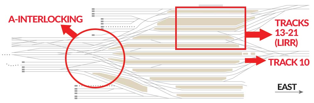
| 1264725 | IsStatenIsland | Good picture of the interlockings and tracks into and out of Penn Station: https://s3.amazonaws.com/assets.projects.newsday.com/projects-uploads/uploads/2017/09/gnew2.jpg |
|||
| 1294584 | IsStatenIsland | PATH platform (9th Street) end (107 meters away from start) |
|||
| 1264728 | IsStatenIsland | IND Sixth Avenue Line pushed to the side down to West 4th Street to make room for proper mapping of PATH tracks |
|||
| 1294585 | IsStatenIsland | PATH platform (9th Street) start |
|||
| 1295473 | IsStatenIsland | PATH tracks overlap platform |