stephankn's Comments
| Changeset | When | Comment |
|---|---|---|
| 61553853 | why is way/615994782 not continued to the east? Probably also connected to the road along the temple? |
|
| 61553853 | why is way/615994900 not connected to way/615994806? |
|
| 62075953 | way/620651765 clearly continues to the north |
|
| 62075953 | way/620651838 is just floating around unconnected to anything else |
|
| 63103608 | and again this changeset. way/629603226 as well |
|
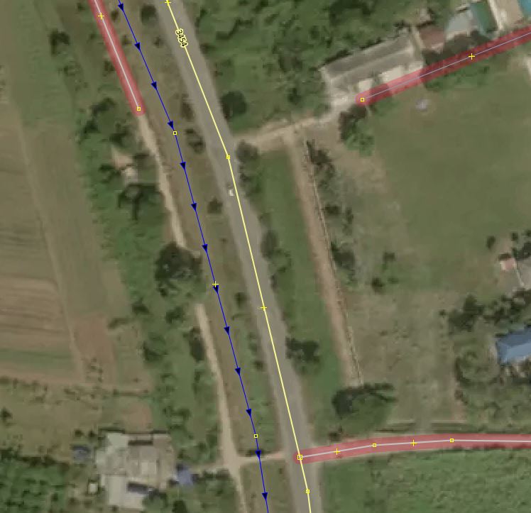
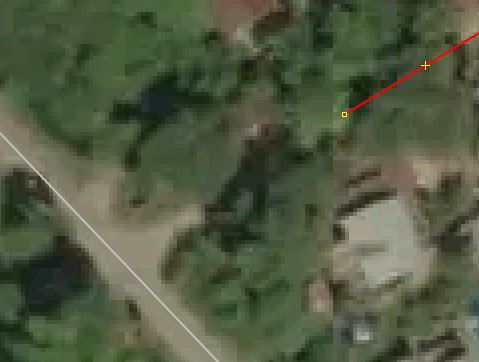
| 63103608 | not another one... way/629603275 ends just in the middle... see https://i.postimg.cc/LscpYWs2/osm-way-629603275.jpg |
|
| 63103608 | seems this changeset is quite buggy. Further west, why is way/629603200 not connected to the road via the gate clearly visible on the western side of the temple?
|
|
| 62080760 | Why is the way (track) north of way/620684047 not continued? this makes a small section of the way next to the canal missing. Other ways along the canal had been added.
|
|
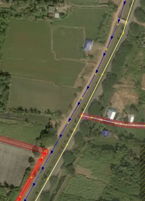
| 63103608 | same image as above, why is way/629603208 not continued south, at least towards that building and connected using the bridge? |
|
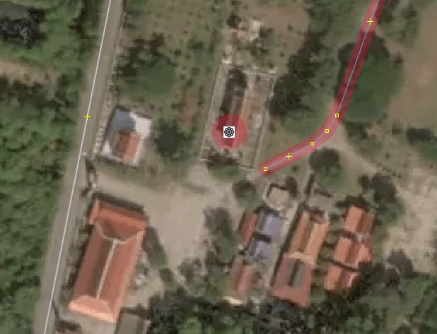
| 63103608 | why is the service road way/629603266 not connected to the main highway? Right now it is an unreachable island. Connection is clearly visible on aerial imagery. Please fix it. See here the current situation: https://i.postimg.cc/wjkykhmC/osm-way-629603266.jpg |
|
| 59187071 | fixed it. see here the original situation: https://i.postimg.cc/Bn3FqKmh/osm-way-590239237.jpg |
|
| 59187071 | Why not continuing the way/590239237 towards the west to the main road? Does not need more imagination than what was already done. Compare with other imagery. And north of that big tree seems to be the road visible in the shade. |
|
| 60444110 | why are the two roads not connected?
They also lead from the major highway 2333 to the village, so unclassified seems to be a much better fitting that for them. |
|
| 60446779 | way/605386379 looks very paved for me (on DG premium). Why tagged as unpaved?
|
|
| 61613504 | new way/616499875 as tertiary, along others, but no reference number. Why do you think these roads are higher than unclassified? |
|
| 54076821 | way: 188319087
|
|
| 54701103 | Thanks for the quick response.
|
|
| 54701103 | My Secret Cafe is a cafe/gallery and already mapped.
|
|
| 59489131 | you removed the railway to the main station. Why? |
|
| 60340409 | Thanks for trying to help improving OSM. Please try to contact some local mappers nearby to get some guidance in how to best tag features. The way "ถนนทางเข้า - ออก โรงเรียนเวียงชัยวิทยามค" is a service road in a school yard. Tagging it as a major highway is quite wrong. I corrected it to the better fitting tagging highway=service. I am also a bit uncertain about the name of it. Is it really named like this? If so, the name is right. But to me it sounds more like you are describing the features, which is something we don't use the name tag for in OSM. Similar the canteen in the school. It describes that it's the canteen, it's not the name of it. So I recommend you revisit it and remove the descriptions. Building names 1-3 are a bit tricky. Maybe "addr:housename" is a better fit for them. Also check the geometry of building 1. Is it really shaped like this? Digital Globe Premium hints that the building is rectangular like the other and just covered by some nearby trees. As you are improving the geometry: Please also make the buildings have a right angle. Use the "Square" tool in the iD menu. |