pwbriggs's Comments
| Changeset | When | Comment |
|---|---|---|
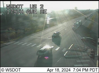
| 177235819 | Hi, thanks for the contribution! I don't see any Flock cameras at this location based on 2021 street-level imagery. The only camera I can see is mounted on the pole at the northeast corner of this intersection, which is the WSDOT US2 mile 13.9 traffic camera (https://images.wsdot.wa.gov/nw/002vc01390.jpg, see https://wsdot.com/Travel/Real-time/Map/). WSDOT traffic cameras are neither ALPRs nor manufactured by Flock. Could you please confirm that there is a license plate reader at this place? I'll add the washdot camera separately because this doesn't seem to be it. |
|
| 177209335 | re: your source tag -- please be careful not to include too much personal info. Otherwise, these edits look good. Thanks for the work on this area! |
|
| 177113963 | Okay, I opened a note. |
|
| 177191625 | Regarding your edit specifically, you mentioned that this is a staircase. I updated this area to change that into a staircase, could you check to see if it looks correct now? Thanks! |
|
| 177191625 | Thank you for the contribution. Please note that it is prohibited to use Google Maps or Google Streetview at all when contributing to OpenStreetMap: see osm.wiki/Legal_FAQ#Contributing You indicated that you made this edit based on local knowledge, so I am assuming that you are only linking those streetview images for reference. That's fine but discouraged because essentially OpenStreetMap wants there to be no question about copyright infringement. FYI, there is some Bing street level imagery licensed for use in OSM. It's not as good or new as Google's imagery, but it's what we've got. To access it, you can hit the "layers" button on the right sidebar in the editor and check the apropriate boxes (there are a few other street-level imagery providers you can also enable, but Bing usually has by far the best coverage and quality in urban areas). Thank you for understanding: we want to ensure that it's completely obvious that OSM's data is 100% legal, which means we try to exercise lots of caution. But thanks for the contribution, we really appreciate this. It's the community of local people carefully adding details like this about the places they know best that, in my opinion, makes OpenStreetMap such a great project. Thanks for being a part of this :) |
|
| 177113963 | @Glassman are you saying that Brian's Auto might not be located here? Or that it probably replaced Quality Auto? |
|
| 177134240 | Thanks. I fixed the tags you used to be in correct, machine-readable format. |
|
| 177113963 | Hey, does Brian's Automotive replace "Quality Auto Sales & Service" which used to be here? Or do the two companies share this space? |
|
| 155376671 | FYI: extra stop at node/12117034894 Thanks for the import; I'll merge that one. |
|
| 176858723 | Thanks! Did Pursuit replace changeset/128916747 (Weintraub Law Office, PLLC)? Or do they share the space? |
|
| 176931717 | Your edit looks good, thanks! I will take a bit (likely a couple weeks) before this change shows up in Organic Maps / CoMaps. Those apps only download new data from OpenStreetMap on a rotating cycle of somewhere between a week and a month. |
|
| 176933627 | Thanks, your edit looks good. Welcome to OpenStreetMap! |
|
| 176692250 | Thank you! This information is very helpful! If you're interested in learning more about OpenStreetMap, please feel free to reach out! OSM US also has a Slack that's very helpful if you have any mapping questions: https://slack.openstreetmap.us/ Once again thanks for your contributions, and welcome to OpenStreetMap! Happy new year! |
|
| 176453903 | Yeah, OpenStreetMap uses British English in the tags, plus some tags weren't necessarily too well thought-out or future-proofed (I think nobody in the early days of OSM expected the project to get this big). So that means sometimes we get tag names (like highway=service) that can be pretty confusing if you're expecting it-- we all get tripped up sometimes :) Thanks, happy new year! |
|
| 176454138 | Are these cameras distinct from the ones already mapped in this corner of the parking lot at node/13110844979? I.e. are there really 4 cameras in this corner, not just the two existing ones? |
|
| 176604653 | Thanks for the edit! This will take a bit (~1 week to 1 month) to show up in CoMaps (it takes the CoMaps project a bit to rebuild the updated data download). |
|
| 176604707 | hmm well the user has a fair point that this might also apply to the park. See my comment of the original changeset. We'll see what they say about what the situation is on the ground. Thanks, happy mapping! |
|
| 176580268 | Thanks. Deleting the park is not correct, but if there is a sign or similar at this park that says something like "residents only" or "no trespassing," we can add access=private to the park and facilities here. Is there a sign to that effect here? For more info, please see osm.wiki/Good_practice#Verifiability and osm.wiki/Why_can't_I_delete_this_trail%3F#Why_am_I_getting_pushback? (that resource is specifically about private trails but some of its points apply here). We want to do what we can to help make OpenStreetMap more accurate. Thank you for your interest in OSM and you patience as we work on this issue. |
|
| 176604686 | Was working on this. I think just adding access=private to the park and facilities would be correct? Assuming there is a sign to that effect on the ground. My guess is that this is a semi-gated neighborhood, where anybody *could* drive in and use this park, but it's strongly discouraged. I'll comment the changeset. |
|
| 176366325 | Thanks for all your edits recently, and welcome to OSM! My only note on this edit is that we typically use +X-XXX-XXX-XXXX phone number format (at least in Washington State). So with a leading plus sign this should be +1-360-479-4440. Happy holidays! |