Piagno's Notes
Notes submitted or commented on by Piagno
| Id | Creator | Description | Created at | Last changed | |
|---|---|---|---|---|---|
| 5175465 | Arrghhh | "Has been closed years ago"
|
|||
| 5176160 | SaintCityMapper | Diese Kreuzung wurde 2025 angepasst und glücklicherweise mit Ampeln versehen. Ausserdem gibt es nun einen gemischten Rad- und Fussweg stadtauswärts. Ich habe die Kreuzung heute fotografiert. Könnte sich dem mal jemand noch annehmen? Vielen Dank! https://drive.proton.me/urls/EZTKQFT2YC#BR14O1Lo6zlQ
|
|||
| 5171153 | Manuel8181 | Bushaltestelle 'Giubiasco, Piazza' nicht eingezeichnet |
|||
| 5169906 | osm_addict | Existiert diese Bushaltestelle noch? |
|||
| 5169707 | profmaad | Unable to answer "Is this still here?" – on level 0: Six (ATM) – node/11371071190 via StreetComplete 62.2: Have been unable to locate it inside the station building or around it. |
|||
| 5167196 | PatrikBo | Offen: Oktober bis Mai via StreetComplete 62.2 |
|||
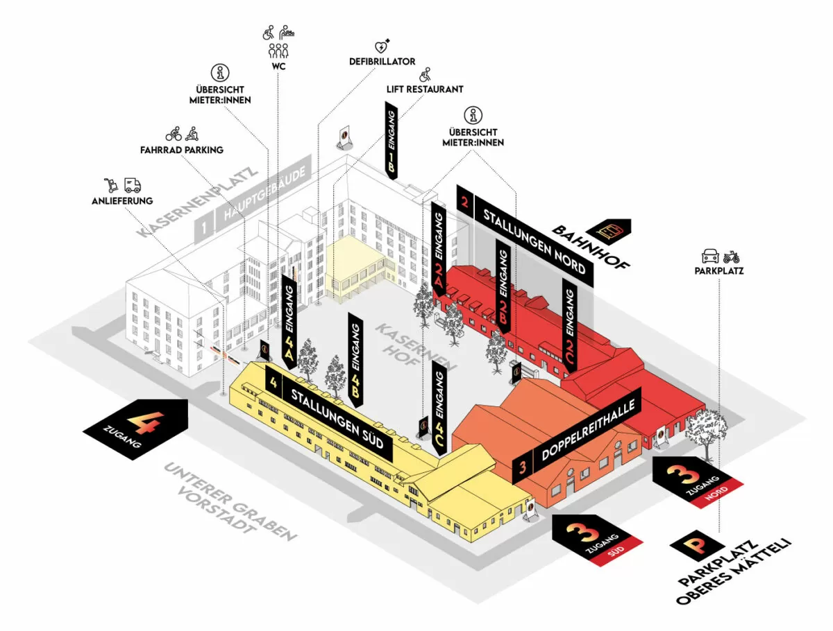
| 5166814 | Teleborian | Karte der Kaserne:
#OsmAnd |
|||
| 5161580 | jon02 | Unable to answer "Are these opening hours still correct?" – Gleis 9 3/4 (Convenience Store) – node/4109460424 via StreetComplete_ee 61.1: Skin estetic |
|||
| 5159953 | North66 | Unable to answer "What’s the surface here?" – Foot Path – way/642092964 via StreetComplete 62.2: Bahnhof Amriswil wird umgebaut. Der Attached photo(s):
|
|||
| 5129305 | Claire‘s hat geschlossen. Favarger wird neu einziehen. |