CoyKoi's Notes
Notes submitted or commented on by CoyKoi
| Id | Creator | Description | Created at | Last changed | |
|---|---|---|---|---|---|
| 2455657 | myfanwy | path heading west from top of steps. survey required to find extent |
|||
| 2496198 | ❤️🔥 | how do cars get here? no way they fit down the <1.5m alley |
|||
| 2497495 | myfanwy | is this useful osm info, or an individual's info on their homestay? it read like the latter |
|||
| 2452341 | CoyKoi | Stoney Batter Fort/Tunnels to reopen to public this summer http://www.waihekegulfnews.co.nz/summer-opening-for-stony-batter/ |
|||
| 2488603 | this building is completed i think |
||||
| 2450166 | CoyKoi | Platform 3 construction is complete and is opening this weekend (5 December)
|
|||
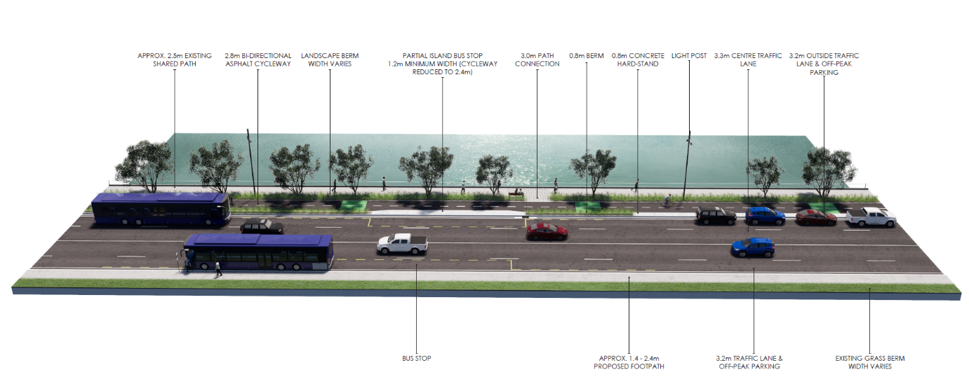
| 2324712 | changes coming to shared path: https://at.govt.nz/media/1978496/tamaki-drive-cycleway-layout.png |
||||
| 2493433 | myfanwy | split landuse around road |
|||
| 2493432 | myfanwy | split landuse at road. also, hillborn rd to the W, hyspecs to the E, bruce roderick to the NW |
|||
| 2493431 | myfanwy | split landuse at road. |