Here I am :-)
Users' Diaries
Recent diary entries
Have started to fill in the area around Coffs Harbour. Fairly new to GPS and mapping but having fun doing it.
The project will move slowly but surely as I make tracks as I work and on weekends.
regards
RRover
...
Tonight I started mapping some small parts of Schönaich. Will try to continue
this over the next weeks, if time allows.

(Copied from my personal blog)
 We held our first WYLUG(ish) Open Street Map micro-mapping event on Sunday and it went well.
Six of us - me, John, Paul, Tim, Simon and Rob - went out mapping and then we went back to Dave's afterwards to start turning the traces into maps.
It was the first OSM event I've organised but I had some advice from Tim (aka chippy) about timings etc and I think it worked out ok. We met for about half an hour to decide where we were all going and we decided on filling in some blank spots around East Leeds. I'd printed out maps and highlighted areas I thought needed attention, and once we'd double-checked no other speedy Leeds-er had filled in our selected spots between me printing the maps out in the early hours of Saturday and us meeting on Sunday afternoon, we headed out.
C'est un test

On 25.02.2008 I was able to identify all streets listed on www.pscpsc.sk for Bratislava suburb Vajnory (ZIP/PSC code 83107).
A little distracted by the earthquake last night so didn't get much sleep. Going tomorrow (Thursday) instead. Same plan.
Mapping out towards Harborne today instead. A few long residential streets I started to do on foot yesterday after getting locked out of the house. Gave up because I don't have the patience to walk long streets when I could cycle them in 1/4 of the time!
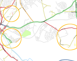
Managed to get back to Grantham today, so I have now mapped the new sliproads for the A1 Northbound, and added a small section of the B1174 heading towards Allington (although I didn't get that far). I've added the new A1 Southbound section, although I've left the sliproads as they were as it's not yet clear whether these will be moved / realigned by the roadworks.
I've recently got a got in Shrewsbury (web developer at Mutiny Desgin) and am going to be commuting by train from Birmingham. Obviously this gives me the opportunity to map various bits of the town after work.
I'm heading up tomorrow (Wed 27th Feb) to try out the journey, taking the bike in order to complete some of NCN 81. I'm happy to meet anyone that wants to come and do a bit, whether they've ever done any mapping before (but I don't have a GPS so you'll have to supply one), although I realise it very short notice and most people have work.
I'll be doing the trip out towards the Oxon Business Park, towards Bicton Heath, (since this is where I'll be working). While there I'll map the business park itself, then head back towards town joining the NCN 81 at the first available opportunity, getting off it by the train station. Then heading back the other way I'll finish off inside the loop of the river before rejoining NCN 81 and following it as far as I can (hopefully as far as Telford.
Is the plan. Weather permitting.

Done some work on the Grunewald in Berlin. There appears to be a whole network of bridleways in addition to the tracks and footpaths. It seems that in order to get a useful and complete map, there is a need for distinguishing between major and minor tracks and footpaths. For now, I hope to use the track surface (surface=dirt) to mark minor tracks, which should render less prominently.
The Grunewald is covered in a grid of rectangular pieces called "Jagen", and there's often tracks along the borders. These borders are usually clearly visible from the Yahoo aerial imagery, but they're not always actual tracks, so there's a few false tracks in the map currently. Maybe these should be entered as forestry=ride or similar? Can anyone point me to forest areas that have been mapped in detail?
There's also a whole network of bridleways waiting to be discovered. Any horse-riding mappers in Berlin?
I've tried adding the various lakes as holes to the Grunewald-multipolygon which turned out not to do what I wanted (for osmarender at least). I'll wait a bit to see what mapnik does before fixing these.
Suburbs Giralang & McKellar in Canberra mapped
On the next sunday we have the first micro mapping parti in Milano.
The party will be an attempt to map a very small part of the city.
A 2 hours ride to cover the entire area and to produce a detailed section of the map.
The editing part of the party will be a personal@home task.
Further info (italian ony) at
This weekend we had a Mapping Party in Perugia (Umbria, Italy). 10 people were mapping in the middle-age town and we encountered problems with the sat signal becouse of narrow streets with tall buildings.
At the end whe managed to produce a nice map (still incomplete).
A big thank to the pople from MindSolution s.r.l who hosted the party.

Went to London Hack Day last Saturday. Twas good. Hacked a bit on MediaWiki extensions.
I have a new profile mugshot photo (Steve's hacking), but where does it show up? On a diary post?
OK I think I can declare Cottenham essentially finished, covering all roads and footpaths in the village. Of course the minute I post this I will discover a whole raft of points of interest that should be on the map.

To enhance trace precisions on a garmin
etrex venture go to the main menu, select
traks, then select the first menu item
on top-right corner of the display (the contextual
menu) and you'll find configuration options
for tracks. The default was likely 'auto' for
the precision, changing to time-based (2 seconds)
made the traces much better (and huge..)
Today I was amazed to find out how many tracks there are in the Grafenberger Wald. The warm weather attracted a lot of walkers, so cycling was a bit difficult. But I think I mapped nearly all tracks that run on top of the hill. In the end I was too lazy to follow all of the up/down tracks, so there are a few tracks missing in the west belly of the forest. Should be easy to do on another weekend.

Yesterday, Steve Chilton, Tom Higgy and I met up for a quick mapping blast around Worcester - one of the few cities in England to have very little OSM coverage.
I tackled the area west of the river, where I'd previously done an afternoon's mapping. It's now mostly complete save for the St John's and Rushwick areas. (Steve worked on the Barbourne area and Tom on the Diglis area, I think.)
And Steve managed to find a table under an out-of-copyright map in the Plough!
Still lots to do in the city, and I'll certainly return to finish off the west side at least, but it's now in a much healthier state than it was before the weekend.
Taking advantage of the extraordinarily warm weather this weekend, i started the first mapping tour by bike to add some small streets around Liedolsheim and Dettenheim (North of Karlsruhe) and continued with Rußheim.