Wow, all of the new features that this place has lately...
Anyhow, I just cleaned up some of the TIGER-imported rail lines and such that had been imported into the area around Stockertown
Wow, all of the new features that this place has lately...
Anyhow, I just cleaned up some of the TIGER-imported rail lines and such that had been imported into the area around Stockertown
I am in Dubai actually and due to the fast paced road construction everywhere the roads are changing very quick.
I found a former road in the map, drawn by somebody else which now does not exist anymore - another road has already constructed in this area.
In another area, a flyover the roads changed. How do I delete the green straight lanes crossing the blue road?
Please give me a clue. I started to join OSM recently and appreciate some help.
So, I've got a plant nursery to map - where does it go? I've put it as a farm, but a farm in (almost) central London seems somewhat odd...
osm.org/?lat=51.501295&lon=-0.204153&zoom=18&layers=B0FT
Ideas?
Looks like the wind farm has rendered on potlatch.
The proposed tag: power=generator; power_source=wind doesn't have any effect yet
osm.wiki/index.php/Proposed_features/Power_plants
Using man_made=power_wind works on mapnik
Neither are shown on osmarender layer - this would be quite useful, as you could see them without waiting a week for mapnik
I think the location might be this one?
Hello
I am new to OSM and I am mapping a totally non-mapped area : Yemen (especially its capital Sanaa) where I currently leave.
Please someone have a look at what I did, and if you have comments, they are welcomed.
sebek
So gestern Daten gesammelt und heute eingegeben.
In Walsheim sollten jetzt 99% der offiziellen Strassen drin sein.
Schleichwege gibt es noch ein paar aber die konnte ich mit
dem Auto nicht anfahren ;-)
Could someone have a quick look over Sandhausen? It's far from finished, but now would be a good time to stop me from mapping b***s***... ;)
TIA!
I need some help from experienced mappers, as I am currently feel unable to join rivers/rivers/coast line. I also having problems in rendering the islands in front of door steps. Naming is here (Vietnam) not THAT important. More seems to be getting the basic shapes and appearances right using one of the underlaying maps as assistance. Exact traces might be even impossible as many parts are are "No Go" area or generally inaccessable ( cliffs e.t.c.). Anyone is welcome to assist, especially those, who wait while their treir are beeing processed.
Regards
TAK
In other words, I cleared a track from my GPS without checking that I had copied it successfully to the PC. What I thought was a track file turns out to have waypoints in it...
Still, got a few more Westport streets and one carpark done.
I have just visited (and tagged) 6 points on the Black Allan line (The straight bit of the NSW Victoria border in Australia). By joining the dots up we now have a better approximation of a segment of a great circle that this border is supposed to be.
It also means that a bridge near Delegate (on Bonang Road) returns to its rightful place in NSW.
I hope that some intrepid OSM'ers will treck to the two endpoints of this line, since the current OSM co-ordinates seem to be about 200 metres SSW of the co-ordinates given by GeoScience Australia and Google Maps/Earth.
PS I then mapped the Bonang Road down to Orbost and I think that this may the twistyest road (of serious length) in Australia, maybe the world. You drive for weel over an hour and you are almost always turning the steering wheel.
It's been quite a few months since I managed to get most of my home town of Lochgelly mapped. It was a great feeling to have mapped almost the entire village! What was once just a spot on the map, is now a complete and comprehensive map of the streets, including post boxes, parking, shops, churches, schools and recycling depots.
There is a new housing estate that is now about half complete. Over the next week or two, I'm hoping to get out and map it. It will hopefully be yet another example of how OSM is "streets ahead" (no pun intended) of the commercial mapping products which can take years to add these new estates. I'm hoping that if I can map this new housing estate, the residents might start using OSM to direct people to their houses!! One can only hope!
Walked around it yesterdag with track! on my mobile phone activated. Nice walk by the way.
Currently modernising road layouts in southern New Jersey, should be finishing up and starting on the New York area as soon as that's done.
And someone needs to update the Orlando, Florida area. half the toll roads are missing.
Greasemonkey is a brilliant plugin for Mozilla Firefox which allows you to run JavaScript snippets on loading certain webpages.
Using Greasemonkey, it is possible to embed OSM into other websites.
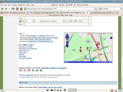
Several months ago, I originally started to embed Ordnance Survey maps into geocaching.com, since there was a reasonable demand for this functionality.
In the most recent version (after working on the OL codebase a little), I added OSM to the available layers for the map widget in an attempt to spread OSM's reputation among geocachers. The good news is that two people have already commented that they're surprised by OSM's coverage, and have started mapping their own data!
I gradually intend to push OSM further up the layer list and hopefully make it the default layer in future versions.
Uploaded and traced many of the residential streets and housing estates of Westport. Unfortunately I didn't have an easy way to note names, so that's an exercise for another day.
I was quite surprised to see that my meanderings for the evening clocked up a total of 31km.
Just tracing some water features around what I guess must be the california aquaeduct. Wikipedia is quite a help in discovering the names of some things. Apparently we might have some government data source available for these, which would be better than tracing?
I found openstreetmap yesterday, someone referenced it in a news comment on heise.de. I planned to have a look at it, learn a little bit about it's technology (and user interface---that's part of my job). I never intented to participate. Ok, maybe a minor fix here or there, same as I do once every couple of months when I visit wikipedia.
Then I found a very big hole where my home village should be. Ok, that alone would mybe not have done it, but the data quality of the streets around it is just horrible. So I looked around for my old GPS...
It took a while, but finaly I found it. I put fresh batteries in, and after about 4 hours on the rooftop it had a fix (not a joke!). And do I need to add, that a "Magellan GPS 300" has no logging or PC connectivity at all? Ok, back to the boxes with old stuff, somewhere should be a Palm. Found it, a nice Tungsten T, but where's the Cradle? Another hour later I found it, too, and also the power supply.Now, let's have a look, some kind of sync software? Yeah, of cause it only runs on PowerPC and has not been updated for 4 yours. Luckily the Windows version runs in Parallels, although it takes about 8 sync runs until it completes.
In the meantime, 9:30 am had passed, so I could go to the nearest electronics store. Yeah, the have satnavs. Plenty of them. And also some 600€ handheld GPSs. But I want a Bluetooth GPS. Ok, let's shorten it_ after I circled the shop 2 times, I found them. Below knee height on the side of the display case. Great selection of three different modells: BT, BT+RDS and USB. I took the simple BT one, 89€ sounded fair (surprinsingly cheap, I had expected to pay twice as much). Now I own a nice "NAVILOCK BT-348"---what, btw, is more or less exacly what I knew about it before opening the ver neutral box.
I add the streets of Bridel.
I add the streets of Hunsdorf
Erste Versuche beim Mapping. Ich fang dann mal mit Wiesbach an.
Bin für jede Kritik offen.
Jeder fängt mal klein an.


