OpenStreetMap logo OpenStreetMap

Diary Entries in English

Recent diary entries

Posted by epicspongee on 6 October 2022 in English.

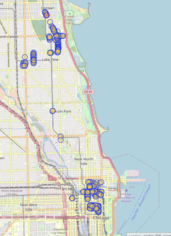
I’m continuing on my quest to map all the bike racks in Chicago, but it’s going a bit slower than I thought. Last update, I had a little less than 200 racks mapped, which is pretty good progress. This update I’ve gotten to 306. Here’s a look:

Screenshot of Overpass turbo showing 300 mapped bike racks

I got a suggestion last time to try using data from the city to help map the racks. Unfortunately, the data from the city isn’t super accurate. It can be off by as much as 2 blocks using the map on the official website. So I got data that was a little more updated, stripped the locations from it (the geocoder used was inaccurate) and punched it into Google MyMaps to see how accurate it was. It’s better, but still not something I’d want to use for actual mapping.

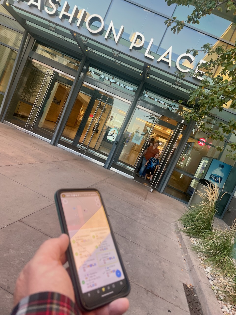
Another approach I’ve tried is using Mapillary. I bought a 360 camera and recorded a few tracks around town. Supposedly they’ll automatically tag stuff using computer vision (bike racks included), but none of my sequences posted more than a week ago have been tagged yet.

See full entry

On September 9-11, 2022, I attended the Wikimedia Summit 2022 in Berlin, Germany as a representative of the Wikimedia Community User Group in Uganda. As someone who belongs to several communities, I was interested in learning from the Wikimedia community lessons that could be replicated by the OpenStreetMap community.

The Wikimedia Summit is the annual conference that brings together Affiliates of the Wikimedia Foundation. The program was designed around the implementation of Wikimedia Foundation’s 2030 Movement Strategy initiatives, and provided a space for connecting, celebrating, learning and planning for the future of the Wikimedia movement.

Wikimedia Summit 2022 Group Photo

Photo by Jason Krüger CC BY-SA 4.0, from Wikimedia Commons

See full entry

Posted by mvexel on 6 October 2022 in English.

After I reconnected with Ilya at SOTM and talked to him about his new app Every Door, I thought it would be nice to organize a mapping party around it back home. I just got back from some Mall Mapping with a small OSM Utah group, and wanted to share my experiences with the app.

every door at the mall

First things first, the app works great. The fact that it’s on Android and iOS and looks and works the same on both platforms is great. The interface is snappy, there’s no annoying crashes or delays, and everything is fairly easy to discover and learn how to use.(However, this is coming from a group of people who have experience with OSM mapping and are at least a little savvy about technology..)

Interface

There were two interface elements that took us a little time to figure out. One was the “modes” at the bottom. The default mode is POIs (the coffee cup icon). It is not immediately clear what the other modes do, but for people with some experience with OSM, you can figure it out in a few minutes.

See full entry

Location: Fisher Place, Murray, Salt Lake County, Utah, 84107, United States

In the recent days I’ve experimented with rendering floor plans using indoor data from OSM. The Simple Indoor Tagging schema suggests pretty lean additive tagging rules to specify the floor level of features and extends to drawing room/area shapes. Well done guys! It’s a very nice and flexible suggestion to add indoor data to OSM.

Turns out coverage of indoor data in OSM is quite limited:

  • Only a few places mapped, mostly university buildings, subway stations and a few shopping centres.
  • Walls are rarely drawn and room polygons touch each other.
  • Doorways are not omitted when drawing walls, in other words there is no hole where doors are located.

This is expected given the difficulty to source indoor data paired with the limited editor support. And frankly, I don’t see much use in mapping indoor data (as part of OSM) except for POI floor levels.

The Simple Indoor Tagging is right in suggesting to map walls only if not already defined by room shapes. Having wall shapes in OSM would dramatically increase the number of nodes and make it more difficult than it already is to edit indoor data. Note that the spatially overlapping room shapes in the different floors are already troublesome to edit unless one uses things like JOSM’s filters extensively.

Being aware of these constraints I came up with the following process to generate walls on the fly:

  1. Cluster rooms, areas, walls, doors, floor level shape by floor level and spatial intersection. Basically collect what is close to each other.
  2. Create wireframes for the walls by collecting the outlines of the room shapes and explicitly drawn walls. This results in approximate centrelines of the walls.
  3. Calculate where the wall wireframe is close to door nodes, buffer (blow up) this part of the wall wireframe to gain the doorway polygons.
  4. Union buffered room polygons and the floor level polygon if available.
  5. Subtract walkable areas, add explicitly drawn walls, subtract doorways.

See full entry

Posted by mvexel on 5 October 2022 in English.

From time to time, I come across mappers that really specialize on a specific mapping topic. I was doing some random mapping in my state when I came across this very well mapped school:

school well mapped

This mapper, Chef7, has mapped lots of schools across the United States in high detail:

See full entry

Location: East Central, Salt Lake City, Salt Lake County, Utah, 84102, United States
Posted by Mercy14846 on 5 October 2022 in English. Last updated on 8 October 2022.

My experience at YouthMappers Workshop, State of the Map (SotM 2022) and Free and Open Source Software for Geospatial (FOSS4G 2022) in Florence Italy from August 18-28 2022.

With My Conference Mentor “YouthMappers is the best, always bringing students, professionals, and industries together”

Actually, this is going to be my first international conference out of Africa it was an amazing conference, and I had the opportunity to meet with different people all over the world. Attending a workshop and two different conferences, I will say it is the best so far.

During the workshop sessions and conference, different organizations hosted additional events, such as HOT unSummit at SotM, HOT unSummit Social in the evening, and YouthMappers Documentary Premiere which was insightful and emotional.

See full entry

Location: Ado Odo/Ota, Ogun State, Nigeria

Hi all,

Hacktoberfest is a yearly event where contributors get a T-shirt from hacktoberfest.com if they improve an Open Source Project.

MapComplete is open for such improvements. Head over to the repository. An ideal to get started is by creating a map layer about something that is interesting to you.

If you have questions on getting started, feel free to ask in our chat channel on matrix/element (telegram bridge )

Posted by b-unicycling on 4 October 2022 in English.

Has anyone ever mapped an area because it was in some true crime podcast or video? I mapped the area (i.e. buildings) in Co. Cork in Ireland where the Sophie du Plantier murder took place while listening to a podcast about it.

And then Netflix went and made a documentary about it and used all that lovely OSM material without attribution.

Location: Dunmanus West, Dunmanus, West Cork, County Cork, Munster, Ireland
Posted by mvexel on 4 October 2022 in English.

I was visiting my HDYC page today. I always get sentimental looking at my first changeset, a neat feature on HDYC. Here it is with ID 90313. This makes sense to me; I lived in that part of Amsterdam at the time and the timestamp coincides with the day I created my OSM account (while participating in a weekend-long mapping party).

But, when I scroll to the bottom of the changeset page info panel, I see there’s a previous changeset:

previous changeset?!

How is that possible? If I click on the previous changeset until there is no more previous changesets, I end up at this one, with ID 7671. But that changeset was opened and closed 10 months later, in April 2008.

I always assumed that changesets with a higher ID would also be newer, but that’s obviously not always true. My best guess is that the database got reshuffled in the early OSM API days. Perhaps coinciding with the disabling of anonymous edits in late 2007?

Mysterious. How will I be able to sleep now?

Location: Central City, Salt Lake City, Salt Lake County, Utah, United States
Posted by pedrito1414 on 3 October 2022 in English.

I really like the ‘notathon’ concept, so just posting a translated version of AngocA’s original diary entry (which was in Spanish).

On Saturday 1 October 2022, a notathon was held, as is customary one week after the Latam meeting. This time it took place in Mexico, and was coordinated by BigBlueButton - OSMVideo, where several people participated.

Notathon Mexico

This time DAMN-project was used to divide the areas. For the division of areas we filtered by only the notes created from the Maps.me application. This is the task of DAMN: https://client.damn-project.org/?area=2407

We showed how to use the JOSM plugin, which automatically downloads the notes, and this allows to work in several areas, without having to leave the editor.

In total 63 notes were solved, with participants mainly from Mexico (alex_mayorga, Mapeadora, Sandra, among others), but there were also attendees from Venezuela (risturiz), Argentina (Manuel Retamozo) and Colombia (AngocA).

See full entry

After you’ve been out dancing 💃 & drinking 🍸 at the club🪩, that take away joint open at 2am 🌆 suddenly looks very appealing 🍔🍟🍕. So for every night club in OSM, I calculated the distance to the nearest fast food take away. Here’s a map of where you have to go >20km for a take away:

map of the world

🗺️ explore this as a web map here

See full entry

Motivations

Have you ever wondered when on earth, you would have opportunity to meet in person, have a handshake, a hug, an off-screen smile, take a coffee or even a lunch together with friends and colleagues you have remotely worked with, as weeks, months and years keeps counting in a virtual world of OpenStreetMap global community? Yes, our trending techs and AI keeps offering us the best of smart connectivity with everyone in a digital space of daily online activities that builds around us a world of virtual communities with uncertainties, barriers and boundaries of never meeting physically in our life time. Have you ever, thought about, the uncertainties of meeting in person such cool guy as Geoffery kateregga and the rest of HOT and OSM Africa local community leaders after consistently working virtually in HOT working groups, OSM Africa Mapathon, Community meeting and the rest for weeks, months and years in a virtual world of OSM.

What about meeting your boss-Pete Masters the Head HOT Global community (of course, if you are a community leader or aspiring and being mentored to be one) after having series of community mentorship, supervision, and virtual meetings through WhatsApp zoom, jitsi and the rest of the virtual platform that makes you forget the distance barrier and that you never had an opportunity to meet in person. Infact, after meeting virtually for years gone by, it only dawned on me that my very boss-Pete Masters had such an intimidating height that would dare me stretching out my neck when I first met him on my arrival for SOTM2022, in Florence, Italy. So, my virtual assumptions were wrong after all, thanks to FOSS4G2022 and unSummit HOT.

See full entry

Location: Alakahia, Obio/Akpor, Rivers State, 500004, Nigeria

RapiD is an alternative to the OpenStreetMap iD editor that adds the ability to easily add data from approved external sources to OSM. Chances are that you—like me—know RapiD from the MapWithAI initiative, Facebook / Meta’s effort to publish road geometry derived from aerial imagery using machine learning. RapiD started out to support this effort; a fork of the iD OSM editor, RapiD added a layer to display the ML-detected road segments, and a nice user interface to add these segments to OSM, connecting them with the existing road network where possible.

rapid in ml roads mode

See full entry

Location: Central City, Salt Lake City, Salt Lake County, Utah, United States